
Kane County Neighbor Record Sources
Kane County neighbor research is strongest when the source matches the question. KaneGIS4 shows parcel geometry and nearby addresses. The county Buffer tool defines a radius and returns mailing labels and PINs. DevNet then shows the tax-roll owner for each PIN. Municipal neighborhood maps add social geography, but they are not lists of people. The voter lookup is an individual registration check, not a public block roster.
| Source | What It Shows About a Block | Access |
|---|---|---|
| KaneGIS4 | Parcel shapes, address points, aerial context, and PIN links | Free public viewer |
| Kane GIS Buffer | Parcels and mailing labels within a chosen distance | Free; owner lookup is separate |
| DevNet tax roll | Owner, mailing address, situs, tax year, and parcel facts | Free public inquiry |
| Aurora and Elgin maps | Named neighborhood or association geography | Public maps; not member rolls |
| Local associations | Public officers, events, projects, and contact routes | Public site or direct inquiry |
A tax-roll result proves only what the assessment record says for that parcel and year. It does not prove that the named owner lives there. Compare situs and mailing addresses, keep trusts and companies in their recorded role, and describe any occupant link as unresolved unless another dated source supports it.
Use Kane County's Neighbor Buffer
The Kane County Buffer instructions describe a precise two-step method. Search an address or PIN in the upper-left box, locate the parcel, choose the gold PinInfo control, enter a distance in feet, and select Mail. The output supplies mailing addresses for parcels inside that radius. Take the returned PINs to DevNet for the separate owner record.
This handoff is an insider detail worth preserving. Mailing output is not ownership data, and an owner is not automatically a resident. Use a modest distance that fits the question. Record the distance, map date, aerial year, and each PIN so another person can reproduce the bounded result.
Map Kane County Nearby Parcels
KaneGIS4 offers map, aerial, and hybrid views plus Parcel, Address, and Subdivision searches. Information windows connect a selected parcel with its PIN, situs label, assessment link, and surrounding geometry. The viewer lists aerial vintages from 2014 through 2025. Choose and note the layer year because newer construction may not appear on an older image.
- Locate the starting address in KaneGIS4 and save its PIN and situs label.
- Set a small buffer or click only the parcels that directly touch the target block.
- Carry each returned PIN into DevNet and capture the tax year, owner label, and mailing address.
- Mark owners and possible occupants as different roles, then stop at the chosen boundary.
The parcel outline is not a survey. Kane's GIS FAQ says compiled official records control, and parcel geometry can differ from assessed area. Use a recorded plat or professional survey for a legal boundary. For a full road rather than one block, use the Kane County street directory workflow.
Kane County Neighborhood Boundaries
Aurora and Elgin publish neighborhood geography that can add a civic name to the parcel map. Aurora's layer records fields such as GROUP_NAME, shape area, and perimeter. Elgin's map identifies Lords Park, Michigan Triangle, Cobblers Crossing, Sunset Park, Southeast Elgin, Near West, Eagle Heights, Parkwood, Downtown, and Gifford Park. These polygons can overlap the postal, subdivision, and tax geography used elsewhere.
The official Aurora neighborhood polygon layer is shown below.
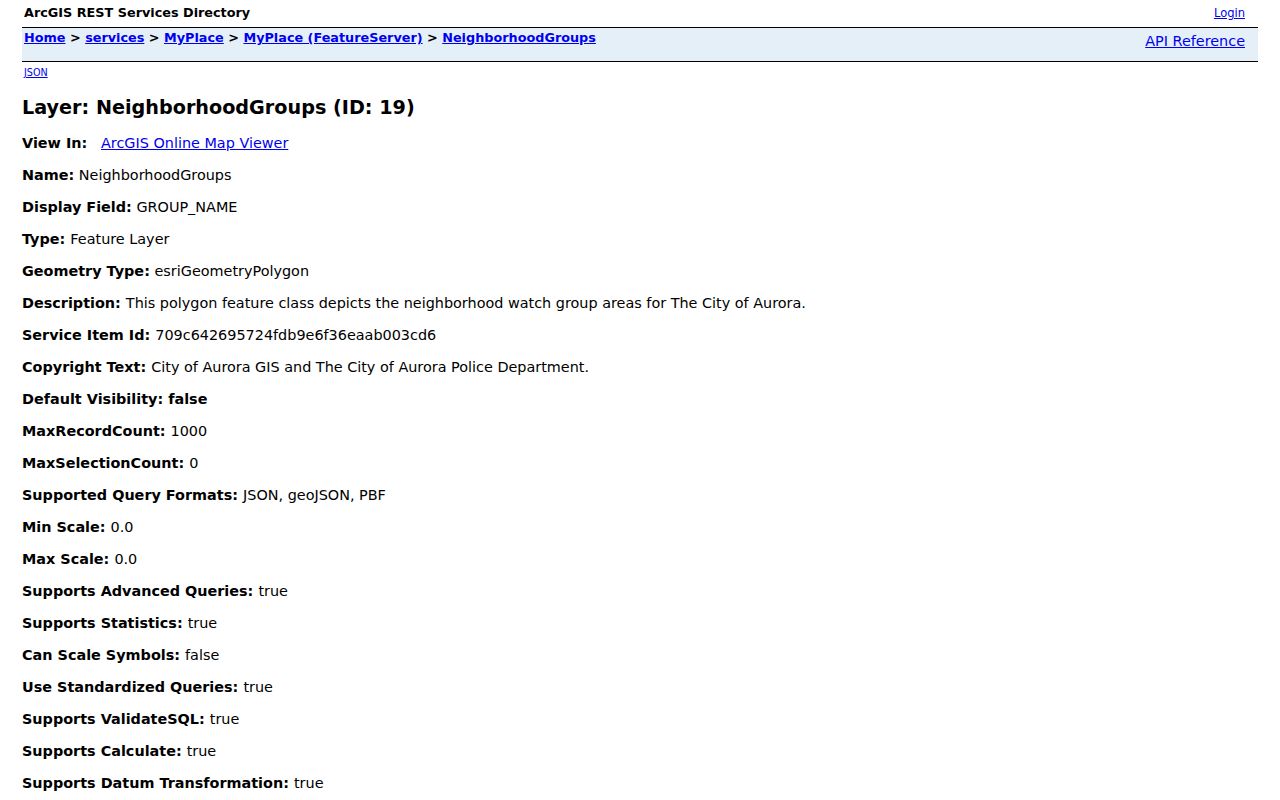
The layer establishes a named area, not a resident list or proof that a household belongs to an association.
Contact Kane County Civic Groups
Community groups can answer questions that parcel rolls cannot, such as public meeting times, cleanup projects, local history, and how to join. Public association pages may name officers or give a contact form, but the research did not verify a countywide public member directory. Ask for public information without requesting private rosters.
Northeast Neighborhood Association
Elgin group with a public website, meetings, projects, and neighborhood contact information.
Aurora Neighborhood Groups
Mapped groups include North East Community Group, Pigeon Hill Neighbors, Blackhawk Neighbors, and Boulevard District Neighbors.
Elgin Neighborhood Network
City maps identify named groups and boundaries that can be compared with county parcel geometry.
The Northeast Neighborhood Association provides a concrete example of the public community layer.
Its page should be used for civic contact and public activity, never as proof about an individual household.
Compare Kane County Neighbor Tools
Official records have narrow purposes and visible custodians. Commercial neighbor tools combine data from many sources, may lag behind a move, and often hide their matching method. A convenient name beside an address can therefore be less useful than a dated parcel result with a PIN.
| Source type | Best use | Main limit |
|---|---|---|
| County GIS and tax roll | Define parcels and identify recorded owners | Does not establish every occupant |
| City neighborhood map | Name civic geography and groups | Does not show members |
| Commercial compilation | Possible lead for later verification | Source dates and matching can be unclear |
Use the official source first, preserve the date, and state only the role that the record supports. That practice keeps Kane County neighbors from being misidentified when ownership, mailing, and occupancy diverge.
Fox River Neighborhood Geography
The Fox River links Aurora, Batavia, Geneva, St. Charles, and South Elgin, but the record trail is not uniform along that corridor. Bridges, historic wards, rail lines, and municipal boundaries can place nearby homes in different city records or library collections. Rural townships and unincorporated pockets may depend more on county GIS and township assessment records.
Record the municipality, township, postal label, and parcel separately. A ZIP label does not establish a city boundary, and a neighborhood polygon does not replace parcel geometry. This layered approach is especially useful where a named subdivision crosses the common way residents describe the area.
Kane Voter Records Stay Individual
The Kane County Clerk's public voter lookup is designed to confirm one person's registration. Its observed fields include first name, last name, house number, street name, and date of birth, followed by a Find button. A valid match can confirm registration details and polling information as the portal permits. It does not support browsing every voter on a block, and it should not be converted into a neighborhood roster.
Illinois election law treats voter data with more care than a parcel map. The research documents a separate voter-data request route with eligibility and use limits, plus protections for people in confidentiality programs. For ordinary neighbor research, use the self-lookup only when the person is checking their own record or has a sound, lawful reason and all required fields. Aggregate precinct data can describe turnout or election geography without naming nearby residents.
This distinction matters in mixed blocks. Parcel lines, precincts, postal labels, and neighborhood polygons answer different questions and rarely share the same boundary. Record which layer supplied each statement. If the goal is simply to contact a civic group, an association page or city neighborhood office is more direct and less intrusive than collecting personal records.
Document a Kane County Neighbor Block
A useful block record begins with scope. Write down the starting address, the buffer distance or chosen intersections, the map view, and the date. Exporting every result is rarely needed. Save only the PINs and public parcel facts that answer the question. If a parcel sits just outside the radius, do not add it merely because its owner name seems relevant.
Next, separate the geographic layers. The situs label belongs to the physical parcel. The tax mailing address belongs to the recipient of the assessment notice. A subdivision name comes from a plat or parcel record. A city neighborhood name comes from the municipal layer. The postal city and ZIP serve delivery. Keeping these labels distinct explains why two people may describe the same Kane County block in different ways without either description being false.
Finish with a verification line for each conclusion. A statement about parcel ownership should cite DevNet and its tax year. A statement about proximity should cite KaneGIS4, the buffer distance, and the map date. A statement about a civic group's service area should cite the city or group map. If the question asks who lives nearby, say when the public sources establish only ownership. That distinction is the key privacy and accuracy safeguard in any neighbor lookup.
Protect Kane County Neighbors' Privacy
Public parcel records do not disclose a complete household. Utility, delivery, and private association data are not general public directories. Illinois voter self-lookup confirms one person's registration through identifying fields and is not a tool for browsing a block. Address Confidentiality Program participants and other protected people may have substitute or withheld address information.
Publish only what is needed to answer a lawful, personal question. Keep the radius small, omit unrelated mailing details, and do not infer a renter, child, or other household member from an owner's name. A record that is open to inspection can still cause harm when copied without context.
Lawful use. Look up nearby records for civic contact, reconnecting, property curiosity, or personal safety. Never use them to watch, threaten, harass, or intimidate anyone.
Note: A nearby tax-roll owner is not necessarily a nearby resident, so every result needs a clear role and source date.